


GPS TRACKMAKER® PRO 5.1 FOR WINDOWS
Geographic Information Made Easy
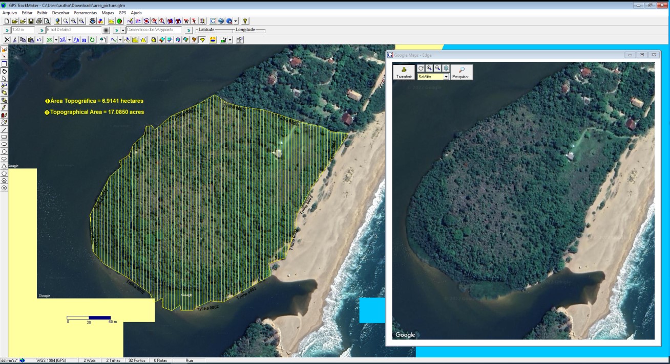
- Capture satellite images and create perfect georeferenced mosaics for offline use.
- Download millions of royalty-free editable vector maps of the entire world from our servers, provided by OpenStreetMap.
- No more GIS complexity, with difficult geodetic definitions. Use the program like Microsoft Paint to create high definition georeferenced vector maps over satellite images. All very easy and quick to use.
- Calculate areas, distances and export data to AutoCad®, ArcView®, QGIS, Excel® and others.
- Compatible with Windows 10 and 11.
For whom the software is suitable:
- Farmers
- Agronomists
- Realtors
- Mining Professionals
- Surveying Professional
- Geology Professionals
- Geography Professionals
- Professionals who use geographic data
Buy and Start Using Now
A single project you do using GPS TrackMaker® will surely pay for more than 10 years of program subscription. What are you waiting for?
What GPS TRACKMAKER® PRO offers to you?
All mapping tools in one software, including advanced GIS tools. Click the button below to see all features.
Not sure if GPS TRACKMAKER® PRO is for you?
Try our popular GPS TrackMaker® Free which has some features of the professional version. Once you become familiar with the software, upgrade to the PRO version.